
"I represent what is left of a vanishing race, and that is the pedestrian...that I am still able to be here, I owe to a keen eye and a nimble pair of legs. But I know they'll get me someday."
- Will Rogers
The Dix Range consists of five mountains: Macomb, South Dix, East Dix, Hough, and Dix, the first four of which are "trailless". I got two consecutive days off a couple weeks ago, so I decided to head North to conquer some more of my 46. I know I really shouldn't have attempted five peaks, especially four trailless, alone, but it's almost impossible to gather people that have the same days off as me AND that want to abuse their bodies like me. So, I took my compass bearings at home, checked them twice, made sure I had all the necessary emergency gear, and headed up to Exit 29.
There are two ways to attack this range: the longer approach via Round Pond, which leaves from Route 73, is about 14 miles RT to do just Dix Mountain, while the route I took from Elk Lake is approximately 12 miles for Dix Mountain, and I feel is the more logical approach to doing the other four peaks. Elk Lake, just 10-15 minutes from Northway Exit 29, is home to the renowned Elk Lake Lodge. Although entirely private, there is a parking lot just before you get to the lake where the trail starts that allows hikers access to the Dix Range, and there is another trail on property that provides access to the long and least used hike to Panther Gorge, Haystack, and Marcy.
The beginning of the trail is very easy. It's as wide as a road (actually, it looks like they might use it as a road) and packed down hard. It is also one of the most eroded trails I've seen in the Adirondacks. My objective for the first day was the leanto/campsites at Slide Brook, just 2.5-3 miles from the trailhead. There is little elevation gain, so I was there before I knew it. Finding the campsites was a tiny bit challenging, as there are a few herd paths that lead into the woods and lead to nowhere. Basically what you should know is this: after you cross the bridge over Slide Brook, there is a campsite immediately to your right. It is marked by a cairn because you must pass through this campsite to get to the herd path that leads up Macomb, the first High Peak of the loop.

Continuing on the Red Trail, though, you'll come to the campsite I used, which is on the right. Across the path from here is a clearing that is not marked as a campsite, but it looks like people have been using it as one. I ate my meals in that clearing and stored my bear canister at the edge of it in order to keep it the recommended distance from my bivuoac. There is also an outhouse, a backwoods luxury, at the edge of the clearing. As you continue down the red trail, you'll soon cross another bridge, just over which is the leanto.
I snagged the last available campsite and was greeted by a pleasant surprise: a fire pit. I was under the assumption that the Dix Range is in the Eastern High Peaks, where campfires are forbidden, but as it turns out it is just over the line separating the Eastern High Peaks from the Southern High Peaks. To add to this surprise, the hiker before me had left massive piles of tinder and firewood, over which he draped large slabs of birch bark. Hikers' courteous ways never cease to amaze me.


Now, for the first three peaks, the herd path was pretty good. That changed dramatically. Between South Dix and Hough, you dip steeply into a deep col before ascending steeply, again. In that col you should find a very remote campsite. It is confusing there because there are herd paths all over the place made by confused hikers. The majority of them peter out into nothingness. Stay to the right of the campsite here to avoid getting lost.
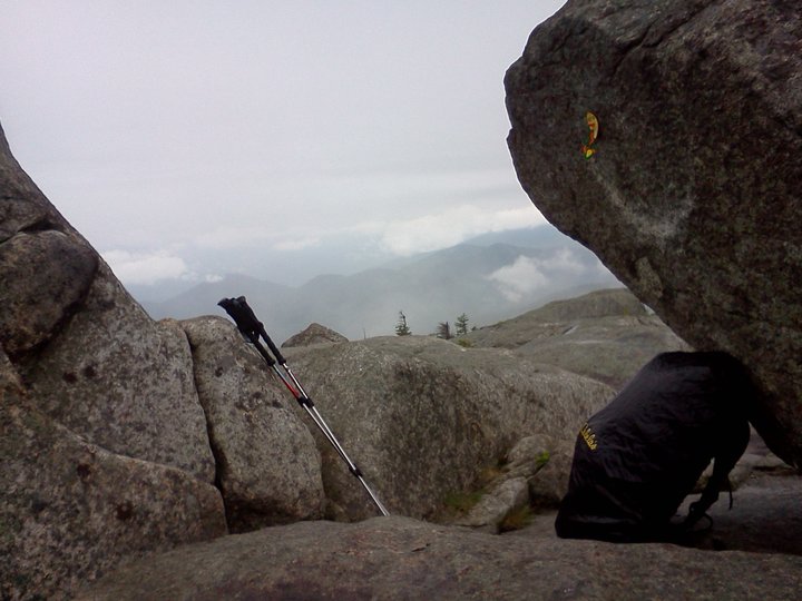
I'm not even sure where Hough's summit was. I passed over it without ever realizing it. At one point, your path is blocked by a large erratic. Nailed to this is a yellow disc with an arrow pointing to the left. I don't know what wise guy put that there, but going to the left is dangerous. The path there goes along the edge of a high cliff with encroaching cripplebush attempting to show you off it with every step you take. After you get past this death trap, you have to fight through incredibly dense bush in order to find your way back to the herd path. I'm assuming this was close to the summit of Hough, but I can't be certain. This is the only time I have ever actually used the term "nightmarish" when describing an Adirondack route.
By this point my knee was in some real pain. My left knee hurt every time I tried to bend it. I was forced to step up every time with my right leg, and step down on my left leg, which even using trekking poles was difficult not to slam down on. According to everything I had read, I should have then come to what is known as "The Beckhorn" - a mountainous nub near the summit of Dix Mountain - and stay to the right of it on my way to Dix. I am also not sure where The Beckhorn was. Somehow I skipped right over it. The trail after what I believe was Hough becomes very bouldery. There are sections where you are forced to wedge yourself between two rocks and shimmy up 15 feet.
In my pain, and having not reached a landmark I recognized in quite some time, I started to get pretty upset. I hadn't seen another person all day and didn't expect I would, considering the incessant rain. There were countless winces, yelps, and curses tossed out. And then, with no warning, I was there: I had reached the summit of Dix Mountain, my fifth peak of the day, and the sixth highest in New York at an elevation of 4,840 ft. I screamed at the top of my lungs. I "woot"ed and struck a truimphant pose. I held my trekking pole over my head like a Tuscan Raider from Star Wars. I had done it: 5 peaks, 4 trailless, in one day. Here is the amazing view I had, haha.

I arrived back at
Dude, all I can say is hardcore! And pacing yourself is really important, glad you made it back in one piece.
ReplyDeleteI am doing a pre-winter run tomorrow and enjoyed your read. Great tips and tricks here as what you did is exactly what I want to do in my winter 46-r quest. I hope all of the black-fly tips I read pay off too!
ReplyDelete