Tuesday, July 12, 2011

The Dix Range


"I represent what is left of a vanishing race, and that is the pedestrian...that I am still able to be here, I owe to a keen eye and a nimble pair of legs.  But I know they'll get me someday."

- Will Rogers

The Dix Range consists of five mountains: Macomb, South Dix, East Dix, Hough, and Dix, the first four of which are "trailless".  I got two consecutive days off a couple weeks ago, so I decided to head North to conquer some more of my 46.  I know I really shouldn't have attempted five peaks, especially four trailless, alone, but it's almost impossible to gather people that have the same days off as me AND that want to abuse their bodies like me.  So, I took my compass bearings at home, checked them twice, made sure I had all the necessary emergency gear, and headed up to Exit 29.

There are two ways to attack this range: the longer approach via Round Pond, which leaves from Route 73, is about 14 miles RT to do just Dix Mountain, while the route I took from Elk Lake is approximately 12 miles for Dix Mountain, and I feel is the more logical approach to doing the other four peaks.  Elk Lake, just 10-15 minutes from Northway Exit 29, is home to the renowned Elk Lake Lodge.  Although entirely private, there is a parking lot just before you get to the lake where the trail starts that allows hikers access to the Dix Range, and there is another trail on property that provides access to the long and least used hike to Panther Gorge, Haystack, and Marcy.

The beginning of the trail is very easy.  It's as wide as a road (actually, it looks like they might use it as a road) and packed down hard.  It is also one of the most eroded trails I've seen in the Adirondacks.  My objective for the first day was the leanto/campsites at Slide Brook, just 2.5-3 miles from the trailhead.  There is little elevation gain, so I was there before I knew it.  Finding the campsites was a tiny bit challenging, as there are a few herd paths that lead into the woods and lead to nowhere.  Basically what you should know is this: after you cross the bridge over Slide Brook, there is a campsite immediately to your right.  It is marked by a cairn because you must pass through this campsite to get to the herd path that leads up Macomb, the first High Peak of the loop.

Continuing on the Red Trail, though, you'll come to the campsite I used, which is on the right. Across the path from here is a clearing that is not marked as a campsite, but it looks like people have been using it as one.  I ate my meals in that clearing and stored my bear canister at the edge of it in order to keep it the recommended distance from my bivuoac.  There is also an outhouse, a backwoods luxury, at the edge of the clearing.  As you continue down the red trail, you'll soon cross another bridge, just over which is the leanto.

I snagged the last available campsite and was greeted by a pleasant surprise: a fire pit.  I was under the assumption that the Dix Range is in the Eastern High Peaks, where campfires are forbidden, but as it turns out it is just over the line separating the Eastern High Peaks from the Southern High Peaks.  To add to this surprise, the hiker before me had left massive piles of tinder and firewood, over which he draped large slabs of birch bark.  Hikers' courteous ways never cease to amaze me.

I spent a beautiful evening by the fire, listening to the soft cooing of not-too-distant bears.  In the morning, after my filling breakfast of oatmeal with strawberries, granola bars, GORP with dried cranberries, and of course, a little caffeine, I embarked down the herd path.  The Dix Range has no consistent water source, so I was sure to carry 3 1/2 liters of freshly filtered mountain water with me.  To my delight, the beginning of the hike was much easier than expected.  I had learned from Adirondack Journey that the Dix Range is well known for inviting storms, but the weather was holding up, and the trail was soft as leaves, not eroded at all, and easily discernible.
And that's when it started to sprinkle.  It stayed a sprinkle until I got to the base of Macomb's slide, and then it started raining in earnest.  Macomb's slide is steep, maybe 45 degrees, and composed entirely of sand and loose rocks.  It's difficult to climb on a good day, and in the drenching wetness, it was a real pain in the butt.  Every step I took I slid back a few inches, sank in, or slipped.  Don't be fooled when you reach the top of the slide, either; you still have a few tenth's of a mile to go before you reach the summit.  In the pictures below you can make out Elk Lake, the storms rolling in, and the top of the slide.  You might also notice that at the time the USGS survey was conducted, Macomb was spelled "McComb".  The mountain, ranked #21 in NYS at an elevation of 4,405 ft, was named after Major General Alexander Macomb, who defeated the Canadians and British in the Battle of Plattsburgh on September 11, 1814. 


From here until the end of my hike, it was difficult to take pictures.  It never stopped raining and I didn't want to damage my phone, which I was using as my camera.  The herd path from Macomb to South Dix, and from South Dix to East Dix continues to be easy and not confusing.  South Dix and East Dix, which some have argued should be renamed Grace and Carson Peaks, both have good rocky summits.  I had no view whatsoever, though, on South Dix, as visibility had dropped to no more than 100 feet.  I had to wait a few minutes on East Dix for the wind to blow the clouds away in order to snap this picture (the summit is marked by that yellow disc.  Trailless Peak canned registers have been removed):
I fueled up at East Dix with some more GORP and granola bars, pounded down some water, and continued on my way.  The route requires you to retrace your steps back to South Dix and then head to Hough Peak.  As I mentioned, I had no line of sight.  Generally, when you're on a summit, you'll want to pick out the next point you're heading to, such as the next mountain, find that bearing on your compass, compare your reading to the bearings you took on your map before you left home, and make the appropriate adjustments.  Since I had no line of sight from peak to peak, I was going strictly by my original compass bearings.  Thankfully, my compass bearings were pretty darn accurate (pats self on back).

Now, for the first three peaks, the herd path was pretty good.  That changed dramatically.  Between South Dix and Hough, you dip steeply into a deep col before ascending steeply, again.  In that col you should find a very remote campsite.  It is confusing there because there are herd paths all over the place made by confused hikers.  The majority of them peter out into nothingness.  Stay to the right of the campsite here to avoid getting lost.

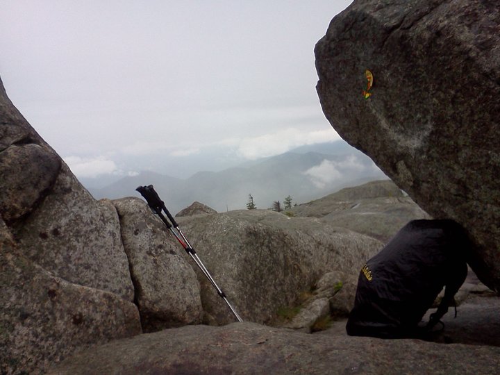
I'm not even sure where Hough's summit was.  I passed over it without ever realizing it.  At one point, your path is blocked by a large erratic.  Nailed to this is a yellow disc with an arrow pointing to the left.  I don't know what wise guy put that there, but going to the left is dangerous.  The path there goes along the edge of a high cliff with encroaching cripplebush attempting to show you off it with every step you take.  After you get past this death trap, you have to fight through incredibly dense bush in order to find your way back to the herd path.  I'm assuming this was close to the summit of Hough, but I can't be certain.  This is the only time I have ever actually used the term "nightmarish" when describing an Adirondack route.

By this point my knee was in some real pain.  My left knee hurt every time I tried to bend it.  I was forced to step up every time with my right leg, and step down on my left leg, which even using trekking poles was difficult not to slam down on.  According to everything I had read, I should have then come to what is known as "The Beckhorn" - a mountainous nub near the summit of Dix Mountain - and stay to the right of it on my way to Dix.  I am also not sure where The Beckhorn was.  Somehow I skipped right over it.  The trail after what I believe was Hough becomes very bouldery.  There are sections where you are forced to wedge yourself between two rocks and shimmy up 15 feet.

In my pain, and having not reached a landmark I recognized in quite some time, I started to get pretty upset.  I hadn't seen another person all day and didn't expect I would, considering the incessant rain.  There were countless winces, yelps, and curses tossed out.  And then, with no warning, I was there: I had reached the summit of Dix Mountain, my fifth peak of the day, and the sixth highest in New York at an elevation of 4,840 ft.  I screamed at the top of my lungs.  I "woot"ed and struck a truimphant pose.  I held my trekking pole over my head like a Tuscan Raider from Star Wars.  I had done it: 5 peaks, 4 trailless, in one day.  Here is the amazing view I had, haha.
The hike back to the campsite was tough.  I had to descend Dix's rock cap in a pouring rain, not being able to bend my left knee without pain.  My trekking poles didn't come with the rubber tips that are used for gripping rock.  I did alot of butt sliding.  After the cap, it continues to be rocky and steep, and like most High Peaks, you pound on your joints with every step down.  I had to compensate for my sore left knee, so by the time I was back to camp, both knees killed.

I arrived back at camp home at 8:45 pm - about 10 1/2 hours of constant hiking later.  It took me 3 hours to travel the 4 miles from Dix back to the tent.  Two days of rest later, my knee felt fine again.  I'm currently shopping around for a good stiff knee brace for hiking, but until then, I just have to pace myself and be careful.  I'm not going to stop hiking these peaks.  It's what I do.  It's what I love.

Tuesday, June 21, 2011

Algonquin, Iroquois, and Wright


"I do not own an inch of land, but all I see is mine."
                                            - Lucy Larcom

One of the single greatest feelings is having a mountain summit or lake to yourself, or a remote section of stream, knowing the nearest humans are miles away.  It's such a release to have a 360 degree panorama and seeing nothing but a luscious green sea of wilderness, the contours of the hills and valleys like the waves of the open sea.  Hawks and falcons soar below you, you can see the shadows of the clouds; there's not a road or sign of mankind in sight.  And even though I don't own an inch of land, I feel like everything I see is mine, and you begin to get a better understanding of just how special the Adirondacks is.  This is my religion, my spirituality, and I feel a desire obligation to protect and preserve this, one of the last great wildernesses in the lower 48 states.

The MacIntyres Range, composed of Mounts Algonquin, Iroquois, and Wright, are visible and easily defined from much of the High Peaks.  I climbed Algonquin and Iroquois on my second trip into the High Peaks, one day after I summitted Marcy for a second time.  My hiking partner was too worn out from the previous day's adventure to join me, so I left him behind at our leanto at Cedar Point on Lake Colden.  We each had a walkie talkie with a 5-mile radius in order to keep in touch just in case something happened.

No matter which approach you take to Algonquin, either via the Adirondak Loj or Lake Colden, the trail is steep.  I later hiked Algonquin and Wright in the winter as a testament to the fact.  Wright lies just off the shoulder of Algonquin and has it's own stories - on January 17, 1962 a military life was lost when First Lt. Rodney Bloomgren got lost in the infamous Adirondack mountain fog and crashed his B-47E strategic bomber into the mountain during a routine training mission.  Pieces of the plane could still be found near the summit for many years, a delightful scavenger hunt for hikers of many ages.  The route to the summit of Algonquin from Lake Colden, though, departs the main trail just north of the outlet to Lake Colden.  From there, it is consistently VERY steep for only about 2 miles.  Partly way, I became a little confused as to exactly where the trail led, only to find that the route had departed the evergreen wood onto a bare rock slab:
After about 1.8 miles, the trail reaches treeline, emerging from the forest at a col between Algonquin and Boundary Mountain.  Boundary itself would be a High Peak, but it doesn't meet the specific criteria laid out; it does meet the standard of having a 300 foot difference from the nearest promontory, but it lies just 0.3 miles from Algonquin, instead of the required 0.5 miles.  Boundary Peak lies between Algonquin and Iroquois.  Historically, it marked the boundary between the Algonquin and Iroquois nations.  When you reach the col, turn north (to your right) to begin your arduous trek up Algonquin's cap.
Algonquin's summit affords a spectacular view of Mount Colden and it's gnarled slides, while Marcy looms behind it.  You also get great views of the Great Range, and Lake Colden and the Flowed Lands.
There was a "Summit Steward" on Algonquin that day.  These are highly dedicated (and measly paid) men and women who every day hike to the summit and spend the whole day there teaching whoever will listen about the fragile alpine vegetation above treeline, the struggle to preserve and regrow it, and what they can do to help.  As you can see from the picture above, storm clouds began to roll in as I sat on Algonquin.  I strongly considered heading back to camp immediately, but was urged by fellow hikers there to get to Iroquois quickly.  "The only way to get to Iroquois is by going over Algonquin, so it would be a shame to pass up this opportunity" they asserted.  I practically jogged the mile to Iroquois.  It's a roller coaster of a mile, though, since you have to go back down Algonquin's cap, then over the [not so] little bump that is Boundary Peak, through an alpine bog (from Algonquin to Iroquois is all technically trailless, mind you), then scramble up what is basically a 15-foot cliff before reaching Iroquois.

What a great decision it was, though.  A couple hikers were leaving Iroquois just as I arrived.  I asked them to snap my picture with Boundary and Algonquin behind me just before they departed.
Iroquois became, and still is, my favorite High Peak.  After they left, I was alone on the summit.  The mountain was mine.  I could see and hear the last people scurrying down Algonquin's rocky cone, and after they left - nothingness.  I could only hear the wind, MY home base of Lake Colden below, a seemingly never-ending wilderness stretched out before me, and a line from the Matrix came into my mind: "This is my world, my world!!"  It's hard to describe, but that was probably my most spiritual moment in the mountains.  My ethereal stupor was broken by the crackling of the walkie talkie; my hiking partner was warning me of the storm moving in.  I knew I had to get below treeline to be safe from lightning strikes and wind, so I wasted no more time in descending.  As soon as I got back down to Lake Colden, the skies opened up and it rained buckets.


I prefer backpacking to daytrips for the main reason that it allows me more time to relax, take in more of my surroundings, get a full-immersion feeling.  In my opinion, you need one full day to wake up, play, and fall asleep deep in the mountains to really allow yourself to relax; one day where you don't even have to think about packing up, no obligations but to do whatever tickles your fancy that day.  One full day to spend in YOUR own world.

Wednesday, June 1, 2011

Cascade and Porter

"When you have worn out your shoes, the strength of the shoe leather has passed into the fiber of your body.  I measure your health by the number of shoes and hats and clothes you have worn out."
          - Ralph Waldo Emerson

I've had the same pair of hiking boots since my first High Peaks adventure.  They're a pair of ankle-supporting Columbia's that I got on sale for $30 (from $60), which is an amazing deal.  I'm looking for a new pair, but all the ones I find that I like are at least $100...oy!  I read in Backpacker magazine that most boots hold together for 350-500 miles; I've had mine for between 450-500.  There are holes in the uppers, I'm missing a couple shoelace grommets, and the inside sole is starting to get pretty worn - but the tread is still great, the toe guard is in fine shape, and the rubber sole is still holding on strong!

Yesterday morning, I slipped on these warriors of hiking boots and headed North to Exit 30.  My plan was to meet up with Kelcey, a friend who lives in Lake Placid right now and whom I'd met while working at Camp Pack Forest, and summit Cascade and Porter.

I had done Cascade once before, but in the winter, and I hadn't been the one driving, so I wasn't entirely certain where the trail was.  While driving down Scenic Byway Route 73, I was rubbernecking at the scenery around me.  I knew the trailhead was next to a thin lake with towering cliffs.  When I passed Chapel Pond, I continued about five minutes before deciding that must be where the trail starts, and I turned around.  Well, turns out that the trail starts much closer to Lake Placid than I remembered, just past Cascade Pond and the Pitchoff Cliffs.  Sometimes you can watch people climb the cliffs at both locations from a distance along Route 73. 

So, I get to the trailhead a half-hour late, but there is cell service for most carriers there, so you can text and let people know what's going on.  This is what the trailhead looks like:
Cascade is the mountain most people do as their first High Peak.  It's less than a five mile roundtrip, not nearly as stressful as Algonquin (which is of similar distance), and has a great rock cap with 360 degree views.  Most people do Cascade and Porter together because the summits are less than a mile apart.  However, I had done Cascade as my first winter High Peak, so I had not yet conquered Porter.

Here's the difference between the trail during the winter and summer:

It was incredibly hot that day.  Once again, I sunburned my scalp, which makes showers so very painful, as well as my arms.  The bugs were also very bad.  I remembered to bring bugspray this time, but it seems like noone else did.  I lent it to many hikers along the way, including a couple that works at the Ausable Club, another necessary and popular trailhead.  Carissa works as the front desk supervisor there and David works at the golf shop.  Being in hospitality I did my best to talk them up, but I'm still working on my networking skills haha.

Here's the difference between Cascade's rock cap in winter and summer, as well:


The bugs were also very bad on the summit.  There was no breeze to drive them away.  I walked around in circles while eating my PBJ on italian rolls in an attempt to keep the black flies off me and my food.  After snapping some pictures we scampered over to Porter, less than a mile distant.  I had heard that the view from Porter left something to be desires, so I was surprised that I found the view to be very nice.
On the walk around Mirror Lake in Lake Placid, they have all the High Peaks and their elevations.

David and Carissa brought their dog with them.  Her name was Kahlua.  On Porter, there was another dog, named Bailey.  So yes, we had Bailey's and Kahlua :-D
Another successful foray into the high Peaks!  I am now an Adirondack 21-er :)

Oh, by the way, we hung out in Lake Placid afterwards.  They are just putting the finishing touches on their new state of the art Convention Center, which I just think is amazing.

Sunday, May 22, 2011

Fishbrook Pond/Black Mountain Shoreline

"Climb the mountains and get their good tidings.  Nature's peace will flow into you as sunshine flows into trees.  The winds will blow their freshness into you, and the storms their energy, while cares will drop off like falling leaves."
           - John Muir

We've received seven inches of rain in the past seven days, and it's not like we were in a drought before that.  Essex County received the worst flooding in its recorded history prior to this new rain, Whitehall is still under water, and homes along the Hudson River had to be evacuated as the river overflowed its banks.

So, of course, I had requested off from work May 17-19 for what I hope will be an annual spring hiking trip.  The forecast was for constant rain every hour until we had hiked out on the 19th.  People thought I was kind of crazy to still go; some friends suggested I build an ark.  But never fear!  With the proper gear and the right knowledge, rainy day activities don't have to be limited to the indoors.  For more fun...just add water!  Besides, I wanted to hike one last time before the Rapture...

So I headed out to my second favorite camping spot in the Adirondacks, Fishbrook Pond on the East side of Lake George.  I met my girlfriend last year at Crane Mountain Pond while meeting a friend there for an overnight, so it seemed right to camp out again with her :)  I was introduced to Fishbrook Pond while working for DEC Camp Pack Forest a few years back.  There are two leantos on the pond with great firepits.  They also stock the pond with fish every spring, so bring your pole if you're into that kind of thing.

The trailhead is at the Hogtown parking area.  It used to start at Dacy's Clearing, but they closed the road that leads to it last year due to budget cuts, which adds an extra 1.7 miles each way of road walking.  Blech!

I could already tell the weather wasn't going to be as poor as predicted - the hike in it hardly sprinkled, though the air was saturated with humidity.  Also, black fly season is upon us.  They were incessantly and aggressively attacking my mucous membranes, making mad darts for my eyes, ears, mouth, and any other moist orafice they could find.  So, we stopped and I reached into my pack and found...nothing!  I had forgotten my bug spray and mosquito headnet - GAH!  I envisioned sleepless nights with swarms around my head and cringed.  Thankfully, this foreboding foreshadowing would not come to pass, as there was a wind ranging from a slight breeze to a violent gale at the pond, which drove the bugs away.

At about 2.7 miles from Hogtown trailhead, or 1.0 miles from Dacy's Clearing, you reach a trail junction.  Head to the right to summit Sleeping Beauty Mountain and continue on through a marshy area to Fishbrook Pond.  This way is longer than the way I went, plus I didn't want to deal with the marshy area after all that recent rain.  We took the left fork of the trail, which heads up a boulder-strewn path, then hooks to the right with views of Lake George in the distance.  This was a little difficult while carrying our packs due to the sticky humidity and rain-slicked rocks, and I kind of wished I had my old trekking poles which were stolen on Sawteeth in the High Peaks.  Grr >:-(  Anyways...continuing up, the trail then flattens out and descends to Bumps Pond.

Just beyond Bumps Pond the trail from Sleeping Beauty comes back to connect.  There's tons of obvious beaver activity in the area.  I noticed several beaver-gnawed stumps, thin trees dragged to the area, and further down the trail, an abandoned and collapsing dam.

Fishbrook Pond is an easy downhill mile from Bumps.  Well, easy when the rocks and roots aren't wet, anywho.  The majority of the trail is also a horse path, so from time to time there may be giant piles of...we'll say "poop" to avoid.  However, the horse trail does end when you reach Fishbrook Pond.

Fishbrook was swollen and slightly overflowing its banks, but not too badly.  As you continue around the pond you'll come to a leanto with a grassy front lawn.  Each leanto has an outhouse, which was much appreciated considering the weather.  The outhouse for this leanto is up the hill and back down the trail a little.  I, however, prefer the leanto on the far side of the pond because it has a nice rocky precipice and, I dunno, I just think it's more picturesque.  It's really just a personal preference.  It takes a good 10 minutes to walk from one leanto to the other and you cross the pond's outlet along the way.  That part was slightly hairy because the stream, which is usually a trickle, was high and moving quickly.  When we got to our leanto, I went out to gather firewood, which I had to go far to get since the area around the leanto was picked clean.  Meanwhile, Courtney began setting up our "home".  Then, she started a little fire for us.

Now, prevailaing winds and storms generally come down Lake George, from North to South.  With that in mind, I had expected the leanto to shield us because it is on the North side of the pond with the opening facing to the Southeast.  I had, though, forgotten to take into account the low pressure system which had brought in the storms.  As such, the winds that night came exclusively from the Southeast in 25-45 mile per hour gusts, straight into the leanto.  In order to block this, and hopefully protect us from the predicted driving rain, Courtney and I fashioned a windblock from the tarp she brought.  We tied it down securely in four spots, then weighed down the bottom with our firewood, also in an attempt to keep that dry.


That night was a bit of a wash (haha!).  It began raining, then got windy, and it was nigh impossible to keep the fire going.  Because of the storms, I couldn't even pick up ESPN Radio on my crank/solar National Weather Service radio, which normally comes in loud and clear.  Then later, I accidentally snapped the crank off it.  Woops.  We went to bed pretty early that night, eager for the full day ahead of us.

We had several options the next day for our dayhike.  We had a hard time choosing between the one-mile hike to Greenland and Millman Ponds, the slightly longer hike to Mount Erebus, and the difficult 3-4 mile one-way down to Lake George's shoreline.  Naturally, we chose the most difficult of the three.

After our leanto, the trail becomes difficult to follow.  Blowdown covered much of the path; we were lucky the trail markers were close enough together to see from one another (although, later on, there IS one random yellow marker between red ones.  Some sly ranger was probably snickering to himself "Tehehe...I'se a funny guy.  This'll be SO funny when someone gets lost!").  If you can battle your way through this jumble, you'll come to a swamp-like area, where the trail opens up, though it was extremely wet.

It is a constant steep descent to Lake George.  I would estimate you descend 1,200 feet or so.  Keep in mind you have to go back up.  There are plenty of beautiful cascades along the way, running heavily while we were there.
 
Like the energizer bunny, the trail to the shoreline just keeps going, and going, and going...but eventually you will reach this gorgeous view at the Black Mountain Shoreline, where there are several campsites run by the state for those without access to the island campsites of The Narrows.


We expected to die on the hike back up, but it honestly wasn't that bad.  In fact, it took us less time to get back than it took us on the hike down.  How much of this was due to us breaking off sticks and using them as trekking poles, and how much was due to us furiously charging ahead to avoid the swarms of black flies?  It's tough to gauge.  But when we got back, the weather was b-e-a-gorgeous.  That night we filled out tummies with some delicious Mountain House meals (Spaghetti with Meatballs and Chicken Breasts with Garlic Mashed Potatoes) and even had some Neapolitan Icecream for dessert.  They are restaurant quality meals.  No longer do we hikers have to stomach those old army packs - blech!  Another great brand is Backpacker's Pantry.

We were able to start a roaring fire that night and we used it to dry out our boots and socks.  We still had no view of the stars - it was overcast the majority of the trip.  It was quite serendipitous and surreal to hear owls hooting across the water.  As we lay down for the night, I even heard that distinct yipping of coyotes not too distant :)
This whole hike, and especially Fishbrook Pond, is like a salamander haven.  I heard a rustling in the darkness near my head soon after shutting out the lights, so I whipped out my headlamp and saw these creepy lil (yeah...little) creature a foot from my face.  It's called a Spotted Salamander.
I had to work at 3 pm the next day, plus pick up my car from the repair shop, so we had to leave early.  We thought we were booking it, but it still took us over two hours to hike the four miles to Courtney's car.  Most of that is because it had poured the night before and the majority of the trail had become a river:
The bugs were even worse on the way out than the way in.  I saw a few totally unprepared hikers coming in.  They looked about 18 and completely naive.  I let them know they were crazy because this was not the day to be making that hike with their lack of gear and knowledge.  Still, we managed to find a few moments to handle this cool lil garter snake.

Fishbrook is a great place to camp that affords flexibility in your full-day dayhikes.  It's also a fantastic place to fish and swim.  I highly recommend it.

Friday, May 13, 2011

Mount Marcy - Cloud Splitter


"I went to the woods because I wished to live deliberately, to front only the essential facts of life, and see if I could not learn what it had to teach, and not, when I came to die, discover that I had not lived."

- Henry David Thoreau

Mount Marcy and I have a special connection.  She was the first Adirondack High Peak I attempted (and summitted).  I've hiked to the top four times, on four separate overnight backpacking trips, in three different months, and from all three possible trails, while staying at three unique, but equally spectacular bivouacs.  It was on that first trip to Marcy that I fell in love with the High Peaks.  Marcy is visible from every other High Peak.  At 5,344 feet, it is the highest mountain in New York State.  Every time I get to look at that signature volcanic profile, I feel as if I'm visiting an old friend; we understand each other so well at this point that no words need be exchanged.

In 2005 I was in my freshman year of college at SUNY Geneseo.  I had never climbed a High Peak and, in fact, I don't believe I had ever been to Lake Placid, despite its proximity (only 1 1/2 hrs drive).  That winter, my friends and I made a pact - that together we would summit the highest peak in the state that summer.  So, I began training by winter summitting nearby Crane Mountain, which in my research I had learned closely mimicked the difficulty and steepness of High Peaks trails, albeit on a much shorter scale.  Eager to get hiking, and needing to do this trip before my summer job began, the fellowship embarked on that first great adventure June 6-8, 2006.

We were clearly green on that first trip.  One member of the party brought a life jacket.  The rest of us carried fishing poles, to which an octogenarian hiker with massive calves at the trailhead quipped "Well, don't you guys look professional!" with the coyest of smirks...of course, due to the high levels of acid rain in the Park, many of the lakes in the region are declared dead.  Here's what the Jeep looked like when we packed it:
The shortest approach to Mount Marcy, and the one we used on Trip #1, is 14.8 miles roundtrip via the Van Hoevenburg Trail, which begins at the Adirondack Loj.  Melvil Dewey, the same man that invented the Dewey Decimal System, was an integral figure in Lake Placid's history.  He was in favor of a simplified spelling system, and thus we have the spelling of the Loj.  As you drive down Adirondak Loj Road you are rewarded with open, expansive views of Mount Algonquin, New York's second tallest.
A general rule of thumb while backpacking is never carry more than 1/3 your body weight.  Many popular trailheads have scales to hang your pack from to ensure you don't hurt yourself; there is one such scale just outside the High Peaks Information Center (HPIC) - an invaluable resource.  Some members of my party were clearly carrying much too much weight.  Just to give an idea, we lugged in a giant two-burner camping stove.  I now use a 3 oz. MSR Pocket Rocket.  The hike into Marcy Dam, a popular camping spot and our destination, is 2.3 miles.  You shouldn't have to stop more than twice.  We had to stop at least five times.
We finally did reach Marcy Dam and claimed a giant leanto.  Exhausted from carrying in our 4 million pounds of unnecessary gear, we took a much needed break.  I had spoken to a ranger at the HPIC about good dayhikes we could do from Marcy Dam, and she said that Avalanche Lake was a must see for first-timers.  I threw together a quick daypack of snacks, water, a map, and a flashlight (just in case), and headed up the 2.8 mile Avalanche Pass trail.  The trail ascends what my dad and I like to call "Misery Hill" (you can guess why) until you reach Avalanche Pass.  Hurricane Floyd in 1999 dumped massive amounts of rain on the Adirondacks, which caused a large landslide in the pass.  You now walk down a trail cut into the very impressive 30 foot tall pile of trees ripped down by the slide.


The trail descends from Avalanche Pass to Avalanche Lake.  The ranger was absolutely correct - it is incredible.  Spectacular.  Words do not do it justice.  Thousand-foot cliffs jut straight into the crystal clear waters.  The only way to get around the lake is via bridges called "Hitch-Up Matildas", which are bolted directly into the cliff face and overhang the water.  I definitely had a recital of heroic anthems going on in my head at this amazing scene.
My favorite approach to Marcy begins at Lake Colden (read: heaven), which is one mile past Avalanche Lake, and I will touch on later.  Nevertheless, the approach from Marcy Dam has its own perks.  From Marcy Dam it is a 10 mile roundtrip to the summit.  Along the way you pass Indian Falls, which provides an open view of the MacIntyre Range (Algonquin, Wright, and Iroquois), and is the last place to fill your water bottles.
I remember that whole first trip we were joking about getting to the top and there being snow there on June 7th.  Well, when we got near the rock cap...yeahhhhh, about that....(hope you can see the snow in the pic)
I loved that hike so much, I decided to hike Marcy again the next year, this time from a different side.  I camped at Lake Colden and hiked up the Opalascent River.  It is wide and the sun warms shallow pools, providing ample opportunity to soak in its refreshing waters.
This is a historically significant route; it's the same path Adirondack-lover Teddy Roosevelt took on his infamous hike to Mount Marcy.  Approximately a mile from the summit is Lake Tear of the Clouds, the highest source of the mighty Hudson River.  It was here on September 12, 1901 that Vice President Teddy was eating a simple lunch of ox tongue (yummy!) when his guide, Harrison Hall, rushed up the trail to hand him a note.  It read: "The President appears to be dying and members of the Cabinet in Buffalo think you should lose no time in coming."  I try to imagine the scene every time I visit.
The third route by which I have ascended Marcy begins at The Garden trailhead and traces Johns Brook, which I will detail in later posts.  My girlfriend and I climbed Marcy via this route just last August.


The Native Americans called Mount Marcy "Tahawus", which means "Cloud Splitter".  My freshman year of college I saw a picture of a man standing on Marcy's summit.  There was a sea of clouds around him, Marcy's cone an island in the mist.  Native American names are always so much more descriptive and emotionally stirring...